Picture a small plane bucking wildly over the Rockies. The pilot grips the controls as sudden updrafts slam the wings. One wrong move, and the aircraft drifts miles off course. Landforms like mountains and rivers do more than shape the earth. They create barriers, trap weather, and twist paths for pilots, boaters, drivers, and hikers alike.
You might think modern maps solve everything. Yet these features still cause surprises. Mountains spawn fierce winds and low oxygen. Rivers hide shifting sands and flash floods. This post breaks it down. First, we look at mountain hurdles in the air and on ground. Then, river traps for boats and travelers. After that, history’s hard lessons. Finally, tech that fights back.
How Mountains Challenge Navigation from Sky to Ground
Mountains block straight lines and stir up chaos. Planes face wild air. Trucks crawl steep grades. Hikers battle endless climbs. These forces make routes longer and riskier. Data shows mountain areas top turbulence reports in the US.
Transport Canada warns pilots about orographic lift in their AIM 2026-1 update. Winds hit peaks and rise fast. This builds clouds and bumps even on clear days.
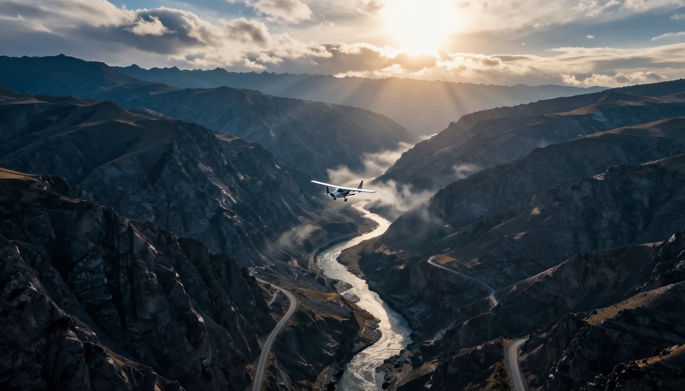
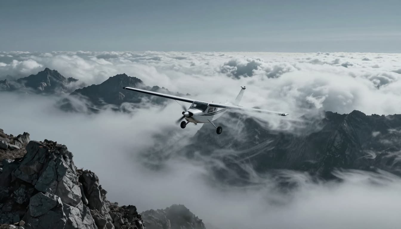
Turbulence and Winds That Toss Planes Around
Air rushes up mountain slopes. It cools, forms clouds, and drops back down. Pilots call this mountain wave turbulence. Planes get tossed like leaves in a storm.
Updrafts lift wings too high. Downdrafts push noses down. A single wave can shove a plane 10 miles off track. Low oxygen at peaks adds fog to pilots’ brains. Hypoxia hits above 10,000 feet without masks.
Rocky Mountain flights like Denver to Jackson Hole rank highest for bumps. Winds shift in valleys too. Planes bank hard to stay level. Check SKYbrary’s article on orographic lift for details on how slopes force air up.
Pilots now scan peak winds before takeoff. Over 25 knots means stay grounded.
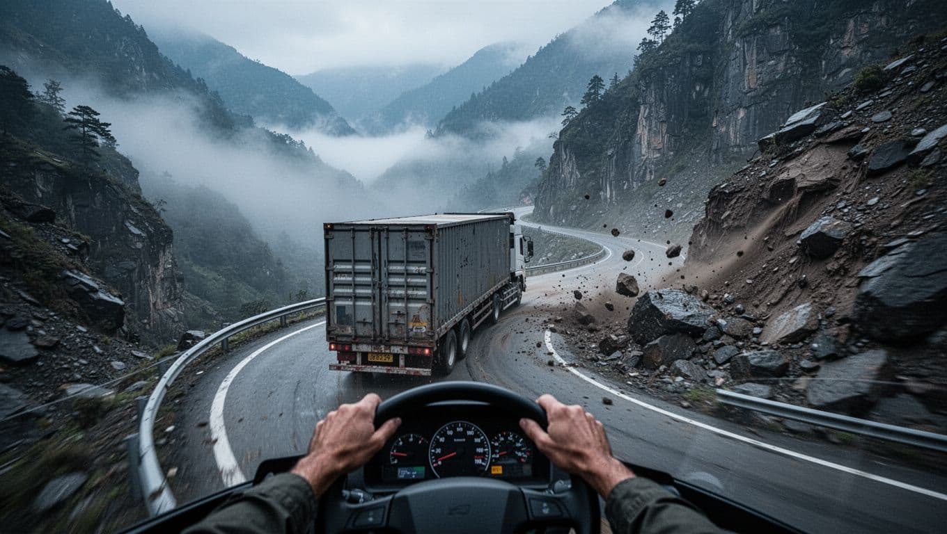
Road and Trail Struggles with Steep Slopes and Slides
Drivers hit sharp curves and 10% grades. Brakes overheat on descents. Trucks downshift to crawl up. Fog fills valleys and cuts sight to yards.
Landslides block passes after rain. Avalanches bury roads in winter. The Appalachians forced early roads to zigzag for miles.
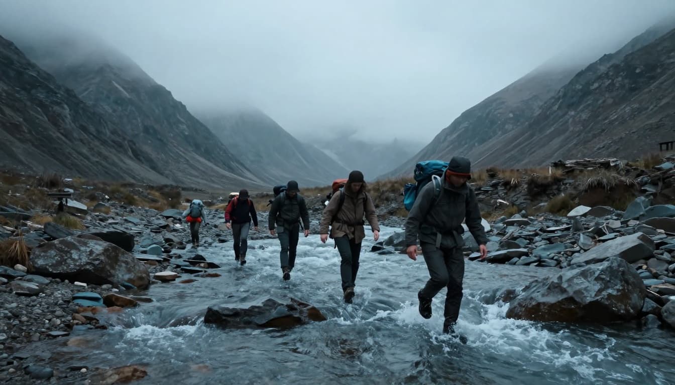
Hikers tire fast on switchbacks. Dead-end valleys waste hours. Flash snow buries trails. Yet ridges offer views that guide steps.
Rivers’ Currents and Floods That Derail Journeys
Rivers look calm from bridges. Up close, they pull hard. Currents hide sandbars that ground boats. Floods erase fords and bridges overnight. Paths shift with every storm.
Boats fight bends where water speeds up. Land travelers scout crossings that turn deadly. These surprises strand even pros.
Boats Battling River Flows and Coastal Surges
Strong currents grab hulls sideways. Sandbars rise after floods and snag keels. River mouths narrow paths with outgoing tides.
Mountains nearby add katabatic winds. Cold air rushes down and whips waves. Storms build fast over water.
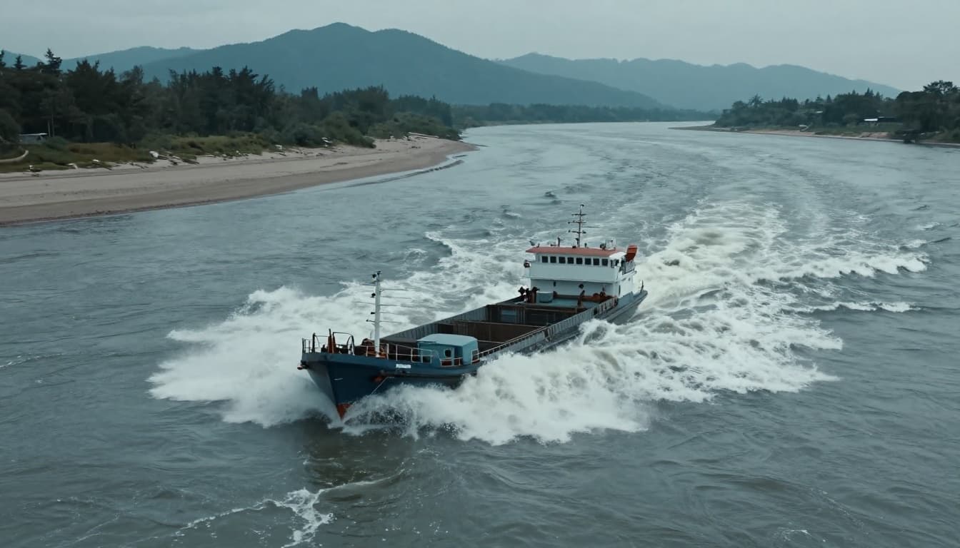
The Mississippi shows this often. High water hides dangers and slows barges. See how flooding challenges navigation there. Captains hug bends to fight the pull.
Flash Floods and Crossings That Trap Land Travelers
Drivers meet washed-out roads. Bridges vanish in muddy torrents. Hikers ford streams that swell in minutes.
Slippery rocks trip boots. One slip leads to deep pools. Valleys funnel rain into walls of water.
No big US river navigation floods hit in March 2026. Still, scouts check upstream rain before crossing.
Lessons from History’s Mountain and River Mishaps
Early explorers paid for ignorance. Lewis and Clark dodged river snags on the Missouri. Mountains slowed their push west.
Settlers in Appalachians trekked months on twisted trails. Powell’s 1869 Colorado River run smashed boats on rocks. Crews hiked out starved.
Planes crashed in waves before radar. A 1930s flight over the Sierras vanished in fog. Wreckage taught better charts.
These tales built maps. Scouts marked safe passes. Rivers got buoys. Errors cut future risks. Read about expeditions that redrew US maps.
History proves landforms demand respect. Prep beats regret.
Modern Tech That Outsmarts Mountains and Rivers
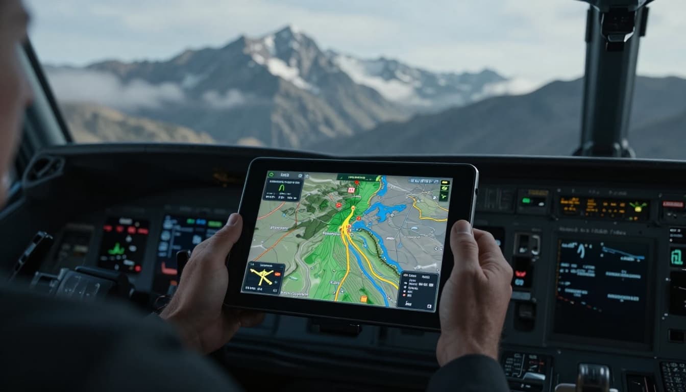
GPS tracks exact spots. Planes use ForeFlight for wind alerts. It shows waves before they hit.
Boats get AIS to spot traffic. Sonar scans river bottoms for bars. Apps predict currents from tide data.
Hikers tap top navigation apps for 2026. Gaia GPS overlays trails on satellites. Avalanche cams watch slides live.
Drones scout floods ahead. Sims train pilots on waves. These tools save hours and lives. Expect AI forecasts soon for sharper paths.
Key Takeaways on Landform Navigation Risks
Mountains whip winds and steepen roads. Rivers hide pulls and floods. Both demand caution in air, water, or boots.
Tech turns traps into guides. Always check apps first.
Grab your map before the next trip. What’s your scariest landform story? Share in comments below. Safe travels.
(Word count: 1,472)